
Fiji – Saweni Bay (Navigation)
Carl Strange Aug 03, 2020
Navigation – What we use on S/V Enchante
Briefly on electronic charts. We carry a full complement of traditional paper charts and have the appropriate set readily available at the Navigation Station for the area of the world we’re cruising. More and more however we rely on electronic charts for route planning and plotting while moving near to shorelines. The program CMap, sometimes running MapSea as an easier-to-use interface, is the most popular charting program in this part of the world. It uses seamless, vectorized charts that cover the world on two CDs so it’s not necessary to buy expensive “chart kit” CDs for various areas. Cap’n Voyager, Visual Navigator, and every other program I’ve had a chance to play with completely fail when planning a route across the E/W dateline. With the exception of CMap/MapSea, every charting program refused to draw the roughly 1000-mile route from Tonga to New Zealand. The program insisted on routing you eastward from Tonga, traveling completely around the world to arrive in New Zealand. The other problem is the limited availability of charts for the “chart kit” type programs. CMap/MapSea has become very popular and has very accurate, usable charts.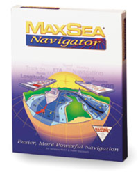
For redundancy, we have two GPSs always installed and running. One at the Navigation Station and one in the cockpit. The electronic charting program is interfaced with the GPS units so it can plot our position on the computer and we can upload waypoints of planned routes.
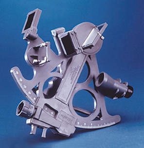
And, yes we carry a couple of sextants – a cheap Davis model and a more proper metal one. We also carry sight reduction tables and an almanac. Once in a rare while, I dig everything out and run a series of star sights. After two or three days I get back in the swing and my calculated position starts getting close to my always-accurate GPS fix. Lightening strikes and complete electronic failure aren’t unheard of on cruising boats.
While we don’t go nuts with formal logkeeping when well offshore we do regularly record our position, course, and speed. We can comfortably fall back to a completely paper-based navigation routine using celestial while well offshore and resorting to taking bearings when approaching land. You’d be surprised how many boats are out here without a clue about navigation other than entering waypoints in their GPS and following the little pointers. We know of nine boats that were lost last year because they ran onto reefs. Two of them completely misread their position and the lights while making evening approaches to Papeete, French Polynesia and this is one of the best marked and lit approaches you’ll ever see. Another ran into South Minerva Reef because they drew a line from Tonga to New Zealand on their electronic chart and didn’t realize their course crossed one of the most famous reef systems in the South Pacific.

Carl and his wife Karen set-off on a journey around the world on-board their sailboat S/V Enchante. Along the way, they had a lot of adventures and in Aruba, a new member of their crew was born. Now a family of three with Rebecca’s birth, they sailed the Caribbean and the Pacific experiencing life along the way.
